Staff Reporter
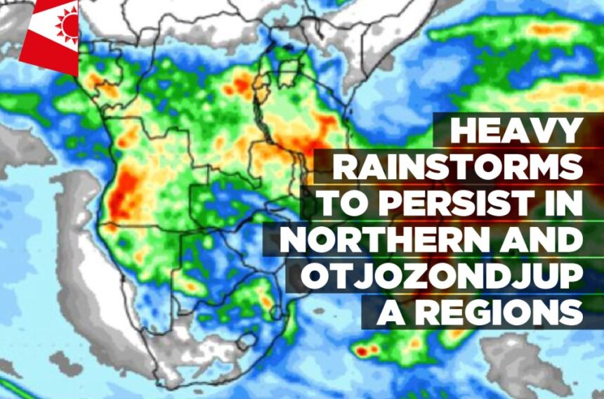
THE ongoing heavy rainstorms, which caused flooding in certain parts of the country, are predicted to persist, with a primary focus on the north-central and Otjozondjupa regions tomorrow.
Namibia Meteorological Services made this prediction, urging caution among residents and visitors in these areas due to the anticipated heavy storms that could lead to flash floods once again.
While the heaviest storms are expected in the northern and Otjozondjupa regions, the rest of the country’s interior will likely also see rain the rest of the week. The rainfall is expected to be widespread, starting in the North, touching places like Rundu and Ondangwa, extending to central areas such as Windhoek, and even reaching Keetmanshoop in the South.
This forecast is further supported by the Hydrological Services of Namibia, which predicted that moderate to heavy storms are expected to persist in the northern and central regions of the country, while light showers are expected in the southern part of the country. According to the Hydrological Services of Namibia, this weather pattern is expected to continue until Wednesday, 14 February.
Recent rainfall in the country has already led to flooding in some areas, particularly in the Kunene and Otjozondjupa regions. However, it has also caused rivers to flood and dams to see increased water levels. Videos and photos depicting the Hoanib, Omaruru, and Hoarusib rivers, among others, in flood, have been widely shared on social media.
The country’s dams have experienced a rise in water levels, with a total content of major dams standing at 57.4% at the beginning of this week, as reported by the Hydrological Services of Namibia. Notably, dams such as Omatako, Friedenau, Otjivero Main, and Naute have recorded increased water levels of 1.2%, 57.1%, 5.2%, and 44.0%, respectively, as of Monday.


Leave a Reply